November 24, Thanksgiving, Day 50

CAPE DISCOVERY SP

Penny made stuffing last night. I made brownies. Today was prepping for a big feast. We had the butcher at the store cut a fresh turkey in half; Penny made gravy using the giblets, neck and such. Sweet potatoes and homemade cranberry sauce rounded out our Thanksgiving dinner. Oh; let’s not forget a bottle of Syrah! We were too stuffed for dessert.

For me, I have so much for which to be thankful. I am living my dream of life as a nomad. I have found a companion to share this voyage of discovery. We consider this life extravagant; we eat like royalty, drink good beer, see amazing sights, and dance to our favorite music in the confines of our tiny house. Our meager retirement income is enough to sustain us. Our health is made strong by living in the outdoors; we walk and ride exploring this great landscape. We feel a sense of “enoughness”, we live in abundance and we are in no hurry (most of the time, except the seven day trip to the continental divide).

I am humbled that the Great Spirit that animates my life and the lives of all the living plants and animals has blessed me, an unworthy servant, with such grace!

November 23, Wednesday, Day 49

CAPE DISCOVERY SP

Grocery shopping at 9am to beat the Thanksgiving rush, refilling LP tank, a little birthday shopping and book store browsing. Using the opportunity to use our phones to catch up on email, texts, and bills, we spent time in the truck typing on our phones. We have no signal at our campground.

After returning to lunch at the Ship and put away groceries, we went exploring the park. We went to the south end of the park to check out the north jetty of the mouth of the Columbia. It partners with the south jetty to increase the water speed of the river in order to move silt out to deeper water. In the past, many boats (three in one week) sunk on the sand bar created by the wide slow mouth.

The upper photo is looking east; the Columbia is on the right. The lower is looking west putting the Columbia to the left. The north jetty is 2.5 miles long; we walked out as far as a pile of boulders impeded our progress. It was from there these photos were taken.

Exiting the truck felt like we were stepping into a wind tunnel. As we walked across the beach towards the jetty the sand was blowing into ours faces carried by 30 MPH winds. But, we pressed on, climbing huge boulders to the top of the jetty where it was virtually flat. It might have been a half mile before we were stopped by four large rocks that we assumed were the end of the jetty, but, no. It went out another 1/2 mile! We did not.

The waves and water were distinctly different on each side of the jetty. The river had large rolling waves moving inland. It was a bit brown from the silt. The Pacific was foreboding white capped surf. Walking back to the truck was much more pleasant with the wind at our backs!

From there, we went to the Lewis and Clark Interpretive Center high on a bluff overlooking the mouth of the Columbia; what a view! The wind was howling and rain pelted us as we reached the bluff and hurried indoors. We spend almost two hours examining the history of the Corps of Discovery; what an accomplishment! They only lost one man to a probable ruptured appendix.
The slave, York, and the woman, Sacquegwea, got to vote on winter quarters, but neither got paid for their efforts. We have come a long way, baby!

The interpretive center is  in the middle background. The Cape Disappointment Lighthouse is to its right on the point.

November 21, Monday, Day 47

CAPE DISAPPOINTMENT SP, 45 mile jump

Penny did her Tai Chi in a clearing in the trees overlooking Willipa Bay. I did my meditations and we left around 11am feeling excited that we could stay at least a week in one place to catch our breath, do some reading, writing, relaxing. Yes!

Walking down to the beach, we were astonished to find black sand that had glitter in it. We came upon two men digging the sand and running it though a sluice to draw out the gold. Sorry, we could photograph the black sand but not the sparkles.

There were interesting things to photograph all around. The North Head Lighthouse, the rock formations at the base of the north head, the driftwood, the seabirds, and a Bald Eagle which flew towards us about 20’ above the sand. I decided to be in the moment and put my camera down. It watched us as it flew by; we spun around to watch his brilliant white tail disappear as it moved away. Magical! Thank You!


November 20, Sunday, Day 46

Pacific County RV Park, 144 mile jump


We took our time leaving Kalaloch; it was very alluring. So, we walked the beach again under bright clouds with smiling faces. We left about 11:30 heading for Ocean City SP, west of Hoquiam about 16 miles. The website looked good and it was about half way to our true destination, Cape Disappointment State Park on the north bank of the mouth of the Columbia River. We drove to the Ocean City SP, but it was basically flooded, with puddles of water in almost all campsites and covering the road in places. We discarded and thought we might get to the Cape before dark, but we needed lunch and diesel.  After we realized we would be setting up camp in the dark at the Cape, Penny fortunately spied a road sign for a county RV park!

So, we pulled in to a grassy field with some some puddles, but nothing serious. They had water and electric for $25. The site was so level we didn’t have to unhook from the truck. That’s a plus! We cooked a sirloin on the BBQ and called my mom, daughter Casey and a bunch of friends to catch up. That was fun!  

It’s good to stay connected on the road; family and friends worry when they hear bad weather reports or just wonder if you are OK.

Penny doing Tai Chi early morning

November 19, Saturday, Day 45

Kalaloch Lodge, 29 mile jump

After a short drive, we arrived at Kalaloch (klaylock. “a good place to land”) Lodge about 1:30pm, 50F and cloudy. It is a part of the ONP and has primitive camping right above the beach. I’ve had family and friends tell me it was a must see. We looked at the campsite map and said, “the far end of loop D!”. Boom! The primo spot at the end of the loop along the fence line was open. It was breathtaking, 20’ above the beach with roaring white surf pounding the sand. Thank You!

The beach is the big attraction here. It is wide at low tide and a good long hike is available. Just be sure you can get back past the rock outcroppings before the tide returns! There is driftwood on the beach, but in smaller quantities and sizes than up north. We walked the beach this afternoon; it was exhilarating! It is a must see; we highly recommend it for relaxing. So pretty!

November 18, Friday, Day 44

The Hoh Rainforest 51 miles

In the continental US, rainforests can only be found on the Olympic Peninsula. The Hoh Rainforest is named after the Hoh tribe of Native Americans. “It receives up to 12’ of rainfall annually and has mild winters and cool summers producing the giant conifers that dominate this forest. Bigleaf maples and vine maples host an abundance of epiphytes (plants growing on other plants) that give the rain forest its characteristic look and ethereal quality. A plethora of mosses, ferns, and plants compete for space on the forest floor, grazing elk keep the understory open. Dead and downed trees decay slowly and support new life as ‘nurselogs.’ The eternal cycle of life and death is strikingly apparent in this magnificent forest community.”

Since this forest was in a national park (ONP), we had the benefit of signage to explicate the theories Penny and I had been postulating in the last few days. The downed elders were called nurse logs and here we witnessed “colonnades”, when a nurse log successfully nourishes a new generation of 8-10 trees along its entire length, each on “stilts” in a straight row. It appeared that after the elder had sufficiently decomposed, the new trees bored roots through it so that the new generation were linked to one another in the space the elder once occupied! That’s quite a metaphor.

Another fascinating aspect of this park was the iridescent moss growing over the maples. We struggled to catch the color digitally, but trust me, it was trippy! The epiphytes look like the Spanish moss which we saw in the bayous down south. I can’t imagine what the maples look like when they leaf out! A very pretty wood pecker was working in this area.

Finally, the conifers were giants; We’d fall over backwards looking upward to see the tops, but they were in such close proximity, you couldn’t see above the canopy. These mammoth trees were 200’ and more. One fell right next to the trail and broke into segments 20-30’ long and was measured at 192’, but the top was never found. It is probably still up above the canopy!

Stilts: the nurse log has vanished.

                                                        A colonnade  of trees

By the way, our good  blessings continue; we had no rain while visiting the rain forest! The road had been closed earlier in the week, but opened today, on our last opportunity to visit on this trip. What can I say? Call it luck, clean living, karma, charm, blessings, or grace, we speak our gratefulness everyday for the opportunities we have been given, the courage to act upon those opportunities, the wondrous gifts we have received, not due to our worthiness certainly, but I believe, in my humble opinion, due to our grateful posture.

The Hoh is home to approximately 400 elk. As we were leaving the parking lot, I told Penny, “I wish we would have seen some elk!” She is not very familiar with them and I was hoping for a close encounter for her to get a good look at one. About one quarter mile down the road two cows were standing in our lane. I was able to get out of the truck and snap a couple of pictures. Thank You!

A poem from the visitor’r brochure I quoted earlier:

When I stop to follow a great bole of spruce from forest floor to the upper canopy,
my perception changes and routine senses of scale and proportion slip away.
In the rain forest, thoughts intuitively yield to a slower and grander pace.

Tim McNulty

November 17, Thursday, Day 43

Retracing our steps we headed back to Clallam Bay at 9AM and 39F under partly sunny skies. We turned toward Neah Bay and took the Hoko River road towards Lake Ozette. Just then, the skies started to darken. By the time we got to the lake, it was torrential! We realized our raincoats and umbrella were not going to properly protect us for the 6 mile out and back in this weather.

My plan “B” was to drive back towards Forks and hope that it wasn’t raining as hard there. It was not; in fact, the partly sunny skies remained. So, I had heard about the town of La Push many years ago from a friend who helped build a highway bridge there. I did not remember any details, but I thought it was worth checking out since it was on the coast just a few miles west of Forks. What a fortuitous recollection!

The town is on the Quileute Indian Reservation, another fishing community having a protected marina and three large haystack rocks out in the bay. We strolled around the docks in the marina and took photos of the rocks and boats. After eating sandwiches in the truck, we left the marina for what is called “First Beach”, adjacent to the marina. The driftwood there was massive and plenteous! I am talking 4’ diameter logs 20’-30’ long by the hundreds, stacked 2 or 3 or 4 deep and maybe 20 yards wide along the shore, for miles! These must have come in before the breakwater was built. There were the typical root balls, but they were 6’-8’ diameter! Other smaller pieces were dwarfed into invisibility.

On the way into La Push, we had noticed signs marking trailheads to “Beach 3, and then, “Beach 2”. The weather was beautiful, so we thought a hike was next on the agenda. Oh my! More primordial forest to ponder and gaze upon slack jawed. This trail was not as undulating as the Cape Flattery, so there wasn’t the need for the many bridges we crossed there. It was nicely maintained especially on the descent to the water, where a sturdy staircase was framed along the ground and filled with pea gravel. What a job that must have been!

The forest was darker somehow compared to yesterday with more recent tree falls whose root balls were still covered by the dirt they lived in for over 100 years. The rainfall is a blessing and a curse. The trees get plenty of water, but don’t have to dig a tap root for it.

.  

As a result, they can become “blowdowns” after reaching great heights. Imagine the sound (that no-one hears) made when a 250’ tall, 10’ thick behemoth comes crashing down bringing many other neighbor trees with it!

The pungent smell of earth and mushroom and decay was dominating the olfactory spectrum. Was it the decay of death or the scent of fecundity? Or, isn’t it both? It is all happening simultaneously: birth, life, death.

Arriving at Beach 2, we found the beach was covered by more large scale driftwood. Luckily, the tide was out so we could maneuver over the logs and find a patch of sand here and there. Never walk on these wood piles when wave action can suddenly rearrange the pile; you might lose a limb, or worse!

The sun was shining in the partly cloudy sky but it was beginning to cool as afternoon waned. So, we took some photos and headed back up and down to the truck. We wanted to buy some smoked salmon from the natives. Following the signs into a residential neighborhood; a nice fellow named Tom met us at his garage door and apologized for being out of fish. But, he pointed across the backyards to his brother’s house. He said he’d call him to let him know we were on our way. Jerry (no kidding!) was coming out the door with a box full of vacuum packed smoked fish. We bought 4 fillets for $20 and went on our way!

November 16, Wednesday, Day 42

Neah Bay and Cape Flattery, 127 mile jump

Planning to find a hotel up on the Strait, we packed our bath kits and a change of clothes and even brought our laundry along. The road to Lake Ozette branches off of the road to Neah Bay so it made sense to save the time and effort to drive all the way back to Forks only to retrace the route tomorrow. We departed about 8:40, the fog lifted and we had glorious blue sky all day long! Going north on the 101, we kept north as the highway turned west at Sappho. Highway 113 runs through the ONF on rolling hills and gentle curves of breathtaking scenery. The road meets the Strait at Clallam Bay where we spied a motel that looked promising. Now heading NW towards Neah Bay, we crossed the Hoko River road that we will take to Lake Ozette, about 30 miles SW, tomorrow. The rest of the drive followed the coastline just above the water level and had tight twists and turns. But, the scenery was magnificent with haystack rocks offshore and intriguing tree covered rock formations along the road.

Arriving at Neah Bay, we stopped at the Makah Museum to acquire the necessary permit for hiking the Cape Flattery trail and headed out, promising to return to examine the museum. I got a great picture of two Bald Eagles sitting together in a snag across the street as we left. The Makah community centered around fishing for centuries and their harbor was modern with many large boats docked at the marina. We wished we could spend time there, but Cape Flattery beckoned! We followed the Tribal Scenic Byway around the base of Mt. Bahokus (1380’), from Neah Bay on the east, then south along the Pacific Ocean to Cape Flattery on the west side; actually on the extreme NW corner of the lower 48!

The Makahs had done a marvelous job of landscaping the trail using large 4” x 12” x 30” planks of clear cedar suspended on cedar rails to avoid muddy areas and undulations in the terrain. They also placed 12” diameter logs in the ground to make stepping logs across muddy areas. The plank bridges were musical; one’s footsteps created sounds of different tonality as you walked along!

The forest really stirred us; this was an old growth forest where death and decomposition nourished new life. We first noticed a large number of trees seeming to be up on stilts, having two or more “legs” with a cave like void under the tree. This was not normal; most trees in the city park have all their roots in the ground. Then, we noticed living smaller trees that had sprouted on fallen ancients and were growing roots over the top and down to the ground. Then, we had an “AHA!” moment: the cave like void was the space the elder held until it completely decomposed! This is a great metaphor of life, each generation is nourished by the strength of its elders. There were giant elders alive and still standing, there were dead elders still standing, there were dead elders lying down, some for a very long time and some obviously very recently. But, all were nursing new life whether on the ground or 200’ above the ground. Be it air plants, birds, fungus, mushrooms, moss or the next generation of trees, it was a system that had been refined over the eons. Is it a nursery or a boneyard?

When we got out to the Cape, the tension between the waters of the Pacific and those of the Straits was palatable. Huge waves were coming from two directions and a great riot ensued. It was anarchy. There was no moment of calm, just the cacophony of surf pounding against one another and the rock cliffs whose formidable appearance had been eroded by the sculpting persistence of small grains of sand in that surf. Great caves ornament the rocky edifice.

Exhilarated after such an experience, we hiked back to the truck. We laughed because of the good fortune of blue sky lasted just long enough for our hike, but it was beginning to rain. On our way back to the museum, the rain was intermittent, but a brilliant rainbow formed. Its right end appeared to touch the ground just a quarter mile in front of us. At one point, there was a double rainbow above the original! As if that wasn’t enough, a Bald Eagle flew toward us off to the right and I got a pair of pretty good pictures! Magical!

We spent two hours in the museum. It was very informative with lots of artifacts recovered from Makah communities in Ozette that were buried many years ago by a mud slide and were unearthed more recently by the changes in the wave action in that area. We were impressed by the craftsmanship in the canoes and the long houses in which they lived. These were not nomadic Indians of the plains needing portable houses (tipis). They had an abundance of food provided by the sea: whale, seals, salmon, clams, oysters and much more. So, they built rectangular cedar plank houses some 50’ long and 20” wide. A few different families lived in one of these longhouses. There was a life sized replica in the museum!

Heading home it was pouring rain, the darkness felt eerie at 4pm. The drive was white knuckled but Clallam Bay wasn’t far and there was little traffic. Unfortunately, the little hotel closed for the season yesterday and there weren’t a lot of other options. In fact, none. So we drove back to Forks where we bought a rotisserie chicken and some beer which we consumed while we did our laundry!
November 15, Tuesday, Day 41

Bogachiel SP     Forks, Wa., 197 mile jump

The day started by visiting a Native Art Gallery near Sequim where we bought gifts for Skip and Teresa and Shawn and Lakshmi. A couple ahead of us in line told the cashier they were from Grand Rapids, Michigan. We chatted, and they too, were out visiting their firstborn grandchild, a 6 1/2 month old girl. What a coincidence!

Our plan was to find a campsite where we could leave the Ship and drive to the plethora of amazing sites without being encumbered by towing. So, we left Sequim about 10:30 and followed the 101 west along the northern edge of the OP. The day started out 46F and blue sky, but as we reentered the ONF, we were driving through heavy rain. Sadly, we were looking forward to the large and pristine Lake Crescent for some photo ops, but not today. We did however encounter a lengthy wait along the lake caused by a tree fall over the road. Continuing west, the rain subsided as we left the ONF. Then Hwy 101 turned south to Forks, one of the larger towns on the OP, where were hoped to get a campsite with utilities. We did find a nice spot tucked in the trees about 2PM.

Using the big map, we planned our sight seeing. Neah Bay was our first choice. There one can hike to Cape Flattery which is the furthest NW point of the US mainland. It is about 60 miles north of here. Our second choice was Lake Ozette, ancestral home land of the Makah Tribe, whose reservation is 28,000 acres of that NW corner. Originally, their lands were over 100,000 acres.

The last big site we had in mind was the Hoh Rainforest, just about 20 miles south of here.

November 14, Monday, Day 40


As we said goodbye to Shawn, Lakshmi, and Mira we still hadn’t decided whether we would go up around the Olympic Peninsula (OP) or head west to Aberdeen and go south on the 101. Buoyed by beautiful blue skies and easy traffic heading out of Seattle, we decided to take the advice so many were giving us, to go north on 101 out of Oyster Bay and see the sites. We have nothing but time and we hurried by lots of scenic places to avoid bad weather on the trip from the Midwest. Freezing temperatures are rare along the Pacific coast. We have become hardened by sleeping in cold conditions and undaunted by rainy weather.


We then said our goodbyes to Skip and Teresa, hooked up the Ship and headed north up the west side of Puget Sound (the east side of the OP) to Sequim Bay SP. The road passed through a number of resort/fishing communities and skirted along the big trees of Olympic National Forest (ONF). Passing through intermittent rain showers, we were awed by the scenery along Hood Canal, Debob Bay and Quilcene Bay. Stopping at the ranger station, we bought a detailed map of the peninsula that was 4’ x 3’; I figured we might need an extra blanket! It’s not conducive to unfolding in the front seat, but it has turned out to be quite useful.


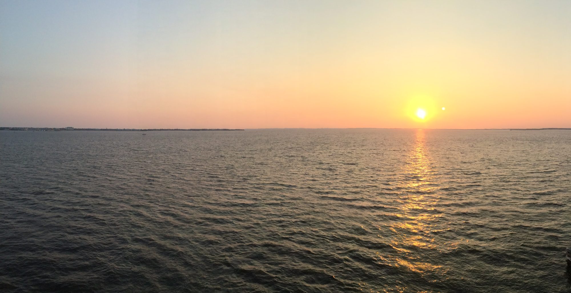
Sequim (pronounced Squim, translated “a good place to shoot”) Bay is on the Straits of San Juan de Fuca, in the NE portion of the peninsula. We opted for a primitive campsite on a bluff above the bay with nearly a 180 degree view of the water. Primitive means self contained, no water or electricity available at the site. We were the only ones in that loop, so it was really nice! It was the night of the super moon; unfortunately its rising was obscured by clouds but it peeked out after 30-40 minutes. Without the horizon, it lost the wow factor.

This is the life we have longed for since last May, adventurously exploring new locations, happy in our rolling studio apartment, admiring creation, focusing on the present moment of our reality and not obsessing over the bad news on the TV; we’ve even cut back on NPR. The last month of visiting has been a true blessing; it’s great to have such great friends and family, but this is the life we both crave.